Start with a plan you can change
You do not need design software to discover that your dream patio blocks the gate or leaves nowhere to put a wheelbarrow. You need a measured sketch that distinguishes what is already there from what you hope to add.
Treat this as a working drawing, not a survey or a construction document. You can use it to compare layouts, estimate areas, and explain your ideas to a contractor, while leaving boundaries, elevations, permits, and structural details to the appropriate professionals.
Gather a long tape, graph paper, pencils, a clipboard, and a helper if you have one. A phone camera is useful for recording awkward corners, but a photograph should supplement the numbers rather than replace them.
Pick a dry day when you can move around without trampling wet beds. If a measurement requires climbing, entering a neighbor's property, or working beside damaged electrical equipment, leave that part unresolved until you can get suitable help.
Choose one fixed starting line
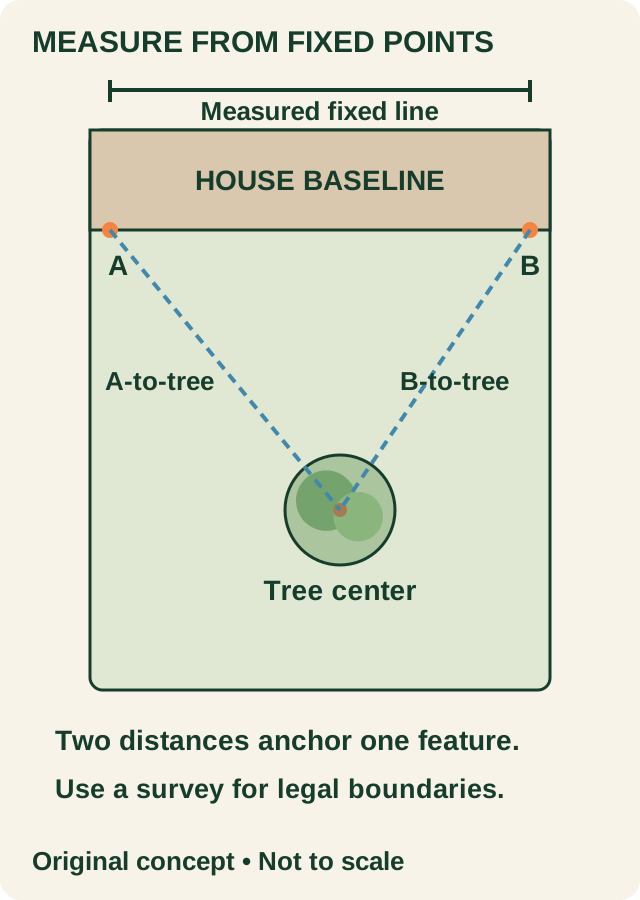
Use a straight house wall as your baseline and give its ends simple names, such as A and B. Measure between those points and write the actual distance beside the line, including any uncertainty caused by shrubs or an inaccessible corner.
Draw the house outline first, with doors, steps, window wells, faucets, and equipment that needs access. A patio that looks generous on a blank rectangle can become cramped once the door swing and the air-conditioning service area appear.
Measure a long wall in smaller connected sections if you cannot stretch the tape accurately in one pass. Add the sections, then compare their sum with a separate overall measurement whenever the site allows it.
Write everything in one unit system before you start transferring measurements. Mixing decimal feet with feet and inches is an easy way to turn a harmless field note into a surprisingly expensive layout mistake.
Locate features from two points
For an isolated tree, measure from A to the trunk center and from B to the same center. Two distances anchor its position more reliably than a single guess about how far it sits from the house.
On paper, you can draw arcs from the baseline ends using those scaled distances and locate the tree where the arcs meet on the yard side. This is an original planning exercise for approximate feature placement, not a method for establishing a legal property corner.
For a bed edge, record several points along the curve rather than trying to capture the entire shape with one width. Add more points where the edge changes direction sharply, and fewer where the curve is gentle.
Measure the current canopy separately from the trunk location. Mark it with a light dotted outline so you remember that a tree occupies space above the ground as well as a point on your plan.
Separate boundaries from things that look like boundaries
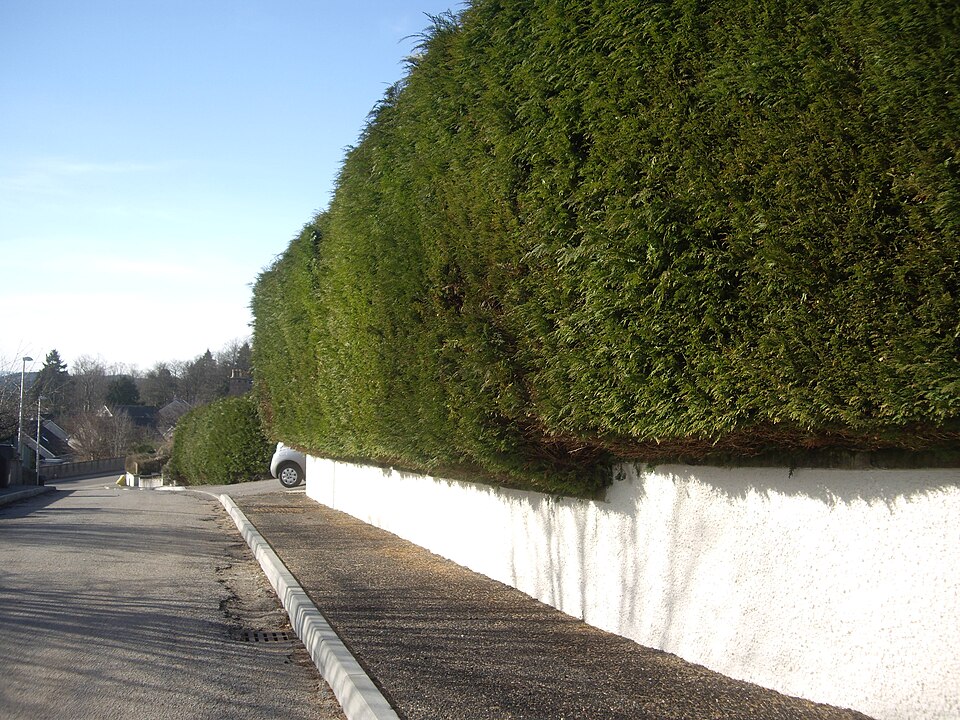
A fence, hedge, or mowing line may suggest where a property ends, but it does not establish ownership. Use an available survey for boundary information and label any line that you have not verified rather than quietly promoting it to fact.
Check with your local planning office before committing to a patio footprint near a boundary. Setbacks, lot coverage, easements, and permit requirements depend on your location and project, so a generic internet dimension is not enough.
Put known utilities, septic components, drainage routes, and access easements on the drawing as constraints. Before any digging, follow your state's utility-location process and ask how privately owned lines are handled, since those may need separate locating.
The University of Minnesota's shoreland planning guide emphasizes surveys, local requirements, drainage, and existing vegetation when making a site plan. Its shoreline rules are specific to that setting, but the habit of identifying constraints before drawing improvements is useful in an ordinary backyard too.
Transfer the sketch to a consistent scale
Choose a scale that fits the full yard on your paper with space for labels. For an example yard measuring 40 by 60 feet, letting each quarter-inch square represent two feet produces a drawing about five by seven and a half inches.
Write the scale in words and add a small scale bar. If you later photograph, print, or resize the plan, the bar gives you a visual reminder that the page may no longer match its original printed dimensions.
Transfer your measured house line first, then locate the other features relative to it. Keep an untouched copy of this existing-conditions plan so a rejected patio idea does not erase the information you spent an afternoon collecting.
Use a separate sheet, tracing paper, or a duplicate digital image for proposed changes. Give the alternatives plain names such as dining-first and open-lawn so you compare actual priorities instead of becoming attached to the prettiest drawing.
Calculate areas without pretending the yard is a rectangle
Break the proposed space into simple shapes you can measure. A 12-by-14-foot rectangle covers 168 square feet, while a right triangle with a six-foot base and four-foot height adds 12 square feet using half the base times the height.
The University of Minnesota Turfgrass Science guide recommends splitting irregular lawn areas into smaller squares, rectangles, and triangles for measurement. It also explains that aerial-image tools give estimates whose usefulness depends on image quality and visible boundaries.
Keep patio area separate from planting area, and subtract a bed only from the area it actually occupies. If two shapes overlap on your sketch, shade the overlap so you do not accidentally count the same ground twice.
Area estimates help you compare options, but they are not a final material order. Paver pattern, edging, cuts, compaction, excavation, and supplier packaging affect quantities, so ask the installer or supplier to confirm the actual takeoff.
Test the layout at full size
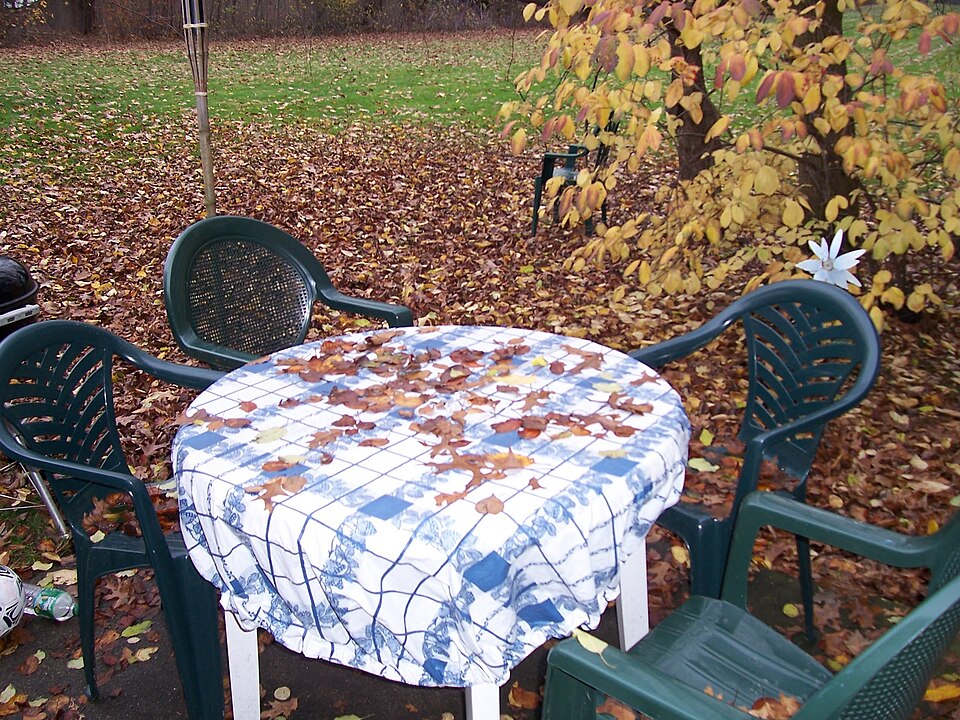
Lay a hose or removable markers around the proposed patio and put your real chairs inside it. Pull a chair back, carry a tray from the door, and walk to the gate while someone remains seated.
You are checking movement, not just furniture footprints. A table that technically fits can still make every trip across the patio awkward if the everyday route runs through the space occupied by a person getting up.
Try a second arrangement before changing the patio dimensions. Moving a table away from a door or replacing an unused oversized chair may solve the problem with less pavement and more planting room.
Photograph each mockup from the same window and from ground level. The overhead plan explains distances, while those views show whether the furniture blocks the garden you wanted to enjoy from indoors.
Hand over the questions as well as the numbers
Before you call the plan finished, remeasure the distances that control the design. Concentrate on narrow passages, door clearances, the connection to existing paving, and any feature whose location would change the proposed footprint.
Put a question mark beside unknown elevations or buried conditions instead of drawing a confident solution. A flat sketch cannot show whether the new patio will send water toward the house, and that issue needs resolution before installation.
Save the dated field notes, the clean base plan, and your preferred alternative together. If another person changes the drawing, keep the earlier version so you can explain whether the difference came from a new measurement or a new design choice.
Your useful endpoint is a clear conversation: here is what you measured, here is how you want to use the yard, and here is what still needs checking. That is enough to move the project forward without pretending your pencil drawing answers every construction question.
Sources & further reading
Exact documentation checked October 15, 2026. Original examples and illustrations; no hands-on product testing or professional certification claimed.
- How to measure the area of your lawnMeasure irregular ground by simple shapes; aerial imagery is an estimate whose usefulness depends on visibility and image currency.
- How to develop a plan for your shoreland propertyA scaled site plan should identify boundaries, local requirements, utilities, vegetation, drainage, and unresolved site conditions; shoreline-specific rules are not generalized.